BIG FDL
3rd Gidea Park Scout Group
web site . . .
HQ. The Rowswell Hall, St Michaels Church, Gidea Park.
 Beavers (6 - 8 years) Tues & Fri | Cubs (8 - 10.5) Tues & Fri | Scouts (10.5 - 14) 7:30 Thur
 UNDER 13s TWO DAY EXPEDITION GOWER 99

A SKETCH MAP OF THE ROUTE
Rocks

Each year on summer camp we encourage each scout to do an over night expedition.  This normally takes the form of a two day Hike.  In 1999 during our summer camp on the Gower Peninsula in South Wales the four oldest scouts were off attempting to complete a Chief Scouts Challenge three day hike.  This Left two younger Scouts in camp so an interesting two day coast route was devised for them.

Also on the Hike were two experienced leaders and we were supported by our GSL.

ROCK HOPPING

On the first day, we picked up extra supplies of sun cream and headed for Worms head.  Worms head is an island that can only be reached at low tide.  We crossed the rocky natural causeway and scrambled round to the natural arch called Devils Bridge.

We lunched on the island before nipping back to the main land before the tide cut us off.

ARCH
THE DEVILS BRIDGE
REAST

After returning from the island we followed the coastal path with the sun on our backs.

Occasionally we dipped down to deserted remote beaches but mostly our route stuck to the cliff top path.

RESTING AT WORMS HEAD

A couple of times we followed the bottom of the cliffs hopping up onto rocks to avoid waves riding the advancing tide.

CLIFFS
JUMPING BEFORE THE WAVE

A bit of scrambling up the cliffs made the days walking more interesting.  The cliffs we did climb were never too steep or particularly high so the Scouts scrambled them with relative ease.

SCRAMBLING UP THE CLIFF

Most of the route was fairly flat, following the cliff tops.  Occasionally it dipped when we crossed small rivers that trickled out across the beach.

A STEEP PATH

At the end of the first day we had walked 13k (8 miles)  Our GSL met us on top of Port Eynon Point with the news that he had booked us into a camp site with a shower, right on the beach.  We pitched the tents, went for a swim in the bay, had dinner and fell asleep. 

THE SETTING SUN

The second day was far easier.  We started by walking about one kilometer along the length of the beach  before returning to the cliff top path.  This was followed for nearly five kilometers to the village of Oxwhich via the end of Oxwich point.

CROSSING A LAND SLIP

On the way to Oxwhich we didn't see anyone.  For the last half kilometer or so the Scouts didn't see an awful lot, the dense undergrowth around the narrow path was significantly taller than them!

MISSING THE VIEW

We sunbathed for a while on Oxwich beach, played a bit of football, swam in the sea which was unbelievably warm for Wales, and this was all before lunch!

LUNCH ON OXWICH BEACH

After another swim we picked up our things and headed towards Threecliff Bay and Pobbles Beach.  We paddled the 3km Length of Oxwhich bay and got around Great Tor before the incoming tide turned the hike into a swim.

WHICH WAY LADS

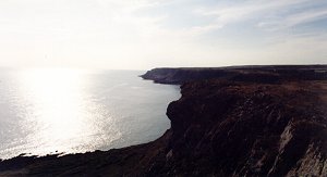
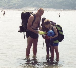
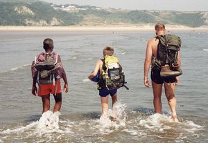
We stopped for a swim at Threecliff beach and then another at Pobbles beach where the huge waves picked up the scouts and the leaders then threw us some way back towards the beach!

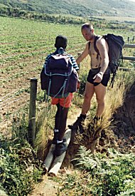
But despite constantly topping up the sun cream we finally realised that we were absolutely frying and headed for shade!

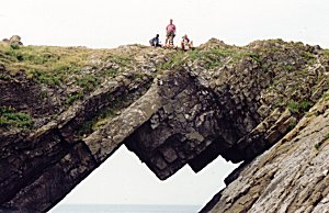
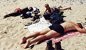
The nearest shade happened to be a natural arch so the hike ended much as it began.  From The devils Bridge to the Pobbles Arch.

RESTING AT WORMS HEAD

We waded in the river for a while before putting our boots on beneath the remains of Pennard Castle.  We then hiked up the valley to Parkmill, for some refreshment before returning to our camp site at Parc-le-Breos