| |
| |
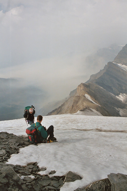 |
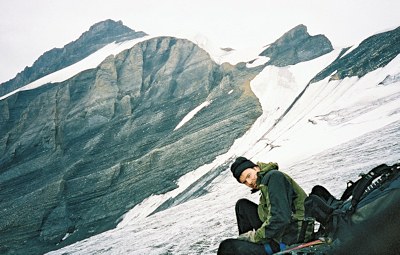
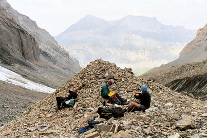
RESTING NEAR THE TOP |
|
The
picture on the left was taken near the top of
the snowfield. In the center of the picture
above Dave's head can be seen the clouds still
covering Leukerbad and to their right the
ridge (the Zackengrat) along which we had just walked. On
the far right can be seen snow fields down on
the glacier from where we had climbed earlier
in the morning.
As we neared the top the weather
started to close in. The Balmhorn has
two peaks and we first reached the lower one
some 30m below and 300m away from the
summit. Lack of energy and closing
clouds caused some of us to question the
sanity of continuing but we were talked into
it.
We descended the first peak avoiding
the bergschrund crevasses and climbed a
gravely rib next to the ice to the final
summit.
|
|
|
 |
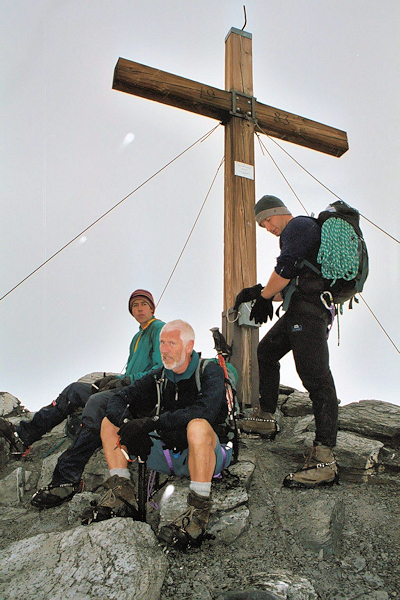
CONTEMPLATING THE LAST CLIMB |
|
|
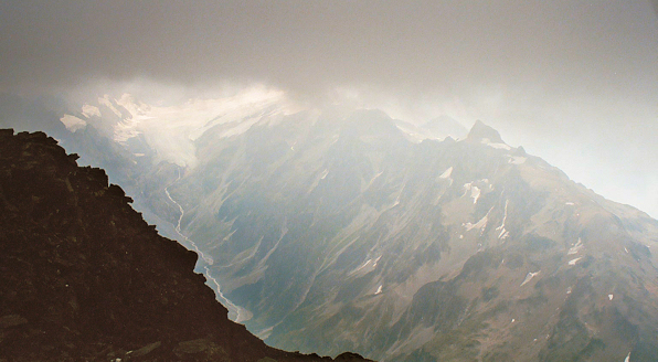 |
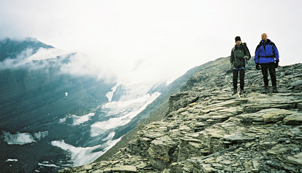
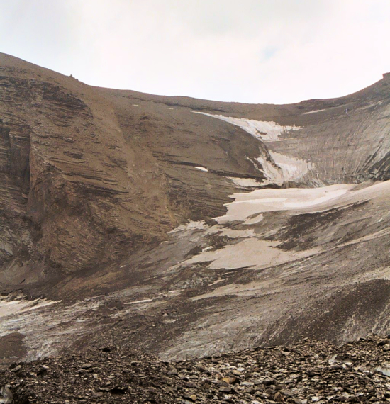
LOOKING DOWN ON THE HOCKENHORN RIGHT OF CENTRE |
|
|
The top is marked by a large wooden cross with a
record book attached. Andy added a note
from us all to the record book as it started to
snow. Before the fog engulfed us we were
able to look down on the Lötchenpass and the
Lötchenpass hut where we had stayed a few
nights before.
|
 |
 |
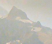
| THE SUMMIT |
|
| The above is the view we had of the Hockenhorn and the ice field on the right, from which Mark and John were rescued a couple of days earlier. |
|
|
Descending mountains is generally considered to be more dangerous than
climbing them. If you trip forwards on a steep slope
you will be falling away from the ground not onto it.
Additionally we would be more tired and in this case
the weather would be worse. It would be fair to
say that none of us were particularly looking forward
to repeating the hellish route from the glacier to the
ridge in reverse.
|
 |
|
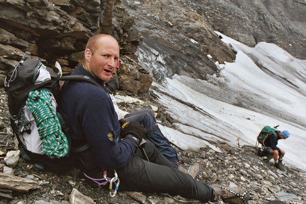
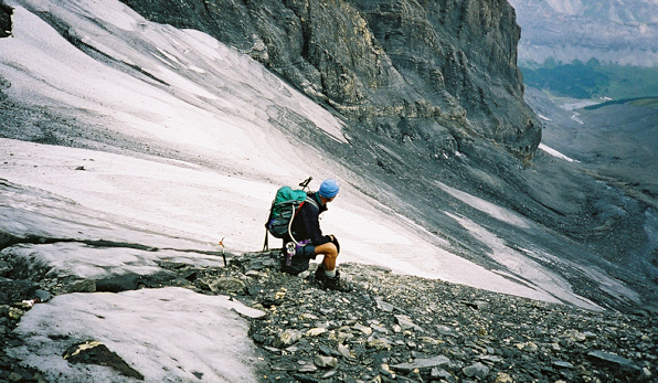
MARK REMOVES HIS CRAMPONS
ALTELS (3630m) IS THE PEAK BEHIND HIM
|
|
|
 |
| GEOFF REMOVES HIS CRAMPONS |
|
|
In the picture above we have just left the ice field beneath the summit. The town of Lukerbad can be seen to the right of Geoff. Our route continues down this ridge and to the right of the small unnamed peak. The peak in the distance on the right is the Rinderhorn (Been there, done that!)
|
 |
| DESCENDING THE RIDGE - SUMMIT IS LOST IN FOG BEHIND US. |
|
|
Fortunately the sleet and rain eased off as we descended the ridge and had more
or less stopped for our slide down the scree ridden
route to the Glacier.
The descent was as
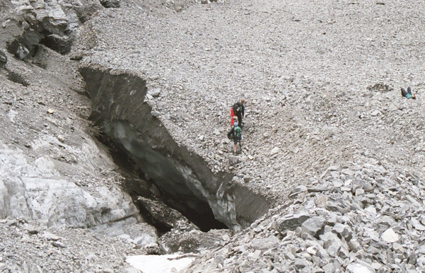
slow and unpleasant as we imagined. When we stopped
to put our crampons on for the final time, Geoff lost
his footing and nearly lost his ice axe and himself
down a small bergschrund crevasse. He ended up
with a cut face as a memento.
|
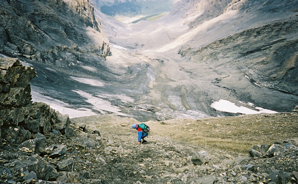 |
GEOFF NEARING THE TOP OF THE GLACIER |
|
 |
|
PUTTING CRAMPONS BACK
ON FOR THE GLACIER
|
|
 |
|
GEOFF PLOTS A ROUTE ACROSS THE ICE
|
|
 |
|
THE DESCENT FROM THE RIDGE - ROLL OVER WITH MOUSE |
|
|
Once on the upper reaches of the glacier we took
a different route down that allowed us to avoid the particularly crevasse
ridden part of the glacier that we had picked our way trough on the
way up. It also allowed us to get much further down the
glacier walking on ice before we had to remove our crampons to pick
our way across lose rock.
To see the route roll your curser over the photo above.
|
 |
|
REMOVING CRAMPONS ON A MEDIAL MORAINE |
|
The higher Glacier was
still avalanching so we skipped across that area very
swiftly and started to search for our bivvy site which we
had never seen in day light before. Here we hoped to
find our sleeping bags still buried under rocks.
|
 |
|
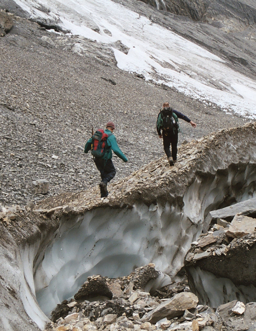
RECOVERING SLEEPING KIT - WHEN PLACING tHE KIT HERE IT WAS DARK & THEY DIDN'T KNOW ABOUT THE ICE CAVE UNDERNEETH |
|
 |
|
WALKING ALONG FOLDS IN THE ICE
|
|
|
At the bivvy site we rested and re packed
our bags. We also considered it warm enough to change
into shorts although some mad members of the party had felt
this was the case from 4am. From hear it was a short
walk to the edge of the glacier from where we would find the
path back into the Gemmi pass.
|
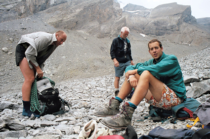 |
SLEEPING BAGS AWAY AND SHORTS ON! |
|
| By the time we were walking
amongst the tourists in the Gemmi pass, we were tired
and probably looked worse. Geoff's blooded
face got a few odd looks on the cable car but we all
felt we had completed a very good hike in a very
safe manner.
|
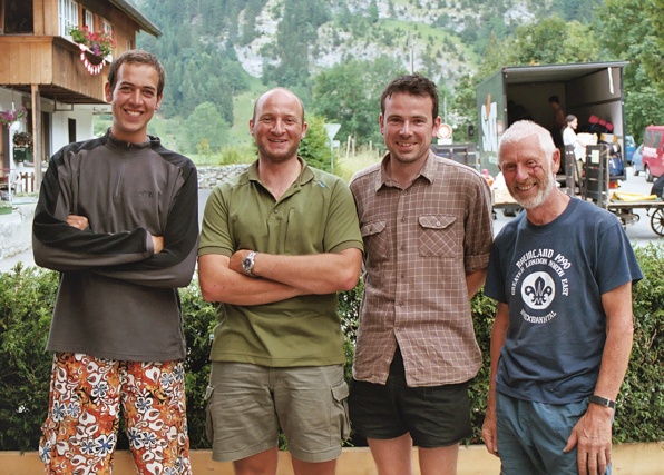 |
BACK AT THE BAR |
|
|
|
