THE LEADERS EXPEDITION

PHOTOS BY MARK AND DAVE

scoutlogo
explogo
netlogo

logo

CAMP HOME PAGE

blank


Route Map

 
Andy
SUNSET OVER VORD LOHNER
 Day 12 

The Explorers were off safely on their expedition and Steve and Jon kindly looked after the Scouts.  This gave Andy, Mark, Dave and Geoff two days to kill.  After much deliberation and consultation with the KISC staff we ruled out an attempt on the Blüemlisapl as the ice was out of condition.  It was then decided to attempt an ascent of the Balmhorn.  At 3699m (12136ft) the Balmhorn is the highest mountain in the region. 

We left the camp site Wednesday evening and caught the cable car up to stock (1834m) in the Gemmi Pass.  From here we walked the 4k gentle climb up to the Schwarenbach hotel (2060m) for a spot of dinner. 
 In order to make the following day's walking as easy as possible we decided to get closer to the mountain and build shelters to sleep in.  We took a very infrequently used path into the valley created by the Schwarxgletscher.  When the path eventually disappeared we descended some steep and slippery scree to the valley bottom.

ANDY TESTS THE SHELTER
MARK AND DAVE BED DOWN

As the sun set and the light fell we followed the river up it's shallow gorge at the valley base.  At about the time we agreed to find somewhere to rest for the night we rounded the corner to be faced with a wall of ice.  We had reached the snout of the glacier.  Climbing onto the ice we looked for a suitable place to spend the night.  The glacier was covered in rocks from years of rock fall so we rarely touched the ice.  There was very little shelter as the glacier was quite flat, all be it with a steady slope up.

We spotted ice and snow avalanching onto our glacier approximately half a kilometer ahead off us.  This prompted us to rest next to a shallow bank of rock piled up on the glacier a safe distance from falling ice. Our recently purchased emergency shelters were used along with three walking polls and some string to build a shelter for four in the dark.  It kept us warm but had it rained I doubt we would have stayed dry very long.  We built a dry stone wall along three sides to keep out the wind.


CRAMPONS ON

LOOKING UP THE GLACIER

We were occasionally woken by the flash of lightning from the valleys far below and the regular rumble of ice and snow avalanching down from the Rinderhorn but our home for the night was surprisingly comfortable for a bed of rocks on ice.  We estimate the altitude of our shelter was approximately 2400m.  Only 300m shy of the Lötchenpasse hut!

DAY 13

We woke before sunrise packed up our shelters and buried our sleeping bags for recovery later.  We slowly picked our way up the glacier which was strewn with rocks.  Andy left his pack with the rest of us while we rested. He nipped off to find a suitable route ahead but came flying back when a loud ruble reminded him of our close proximity of the avalanche field.  We would drop down below the danger zone and continue up the other side of the valley.

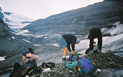
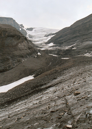
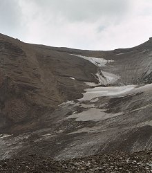
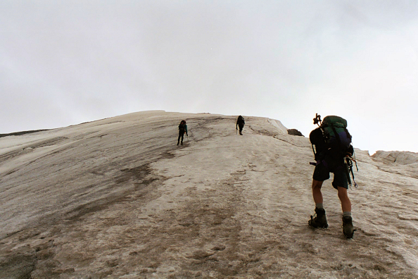
The recommended route for summer walkers is to walk half way up the glacier before climbing onto the ridge.  The 
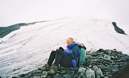
ridge can then be followed to the snow fields between the top of the glacier and the summit.  This avoids the crevasse strewn upper part of the glacier.  However as we found the climb up to the ridge is perilous, steep and slippery.

Roll your cursor over the picture on the right to see the route we took up.

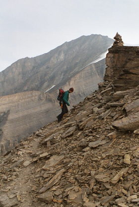
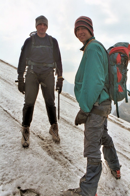
Crampons were required for the steep ice at the bottom.  Once crampons were off both Dave and Geoff found themselves stuck momentarily on the slippery steep rock.  Andy went down to assist whilst mark cut steps in the adjacent snow field.

THE ASCENT TO THE RIDGE

THE RIDGE AT LAST (3110m)

Once off the ice the slow climb up the scree to the ridge was very tiring, slippery and generally unpleasant.  None of us dared get our cameras out for fear of losing balance.  On reaching the ridge we rested, admired the view of the other side and consumed a snickers.  The worrying thing was we could see the town of Leukerbad 1700m below was covered in rain clouds the top of which were only 800m below us and rising!
Although the path along the ridge was not as steep as our previous climb it was still very hard work partly due to the thinner air but also because we had used an awful lot of energy on the way up.  We moved as quickly as we could with an eye on the clouds below.

DAVE ON THE RIDGE PATH

ANDY SITS TO PUT CRAMPONS ON

At just over 3300m the rocky ridge meets the snow field on the west side of the peak.  From here crapons were needed for the final steep ascent up the smooth snow and ice field to the summit.
THE ICE FIELD
 Once again the final climb was very tiring and most of us would need to stop for a quick rest every six steps or so.  Most of the time the spikes on our crampons were digging into hard ice but occasionally we crossed small patches of snow.

CLIMB

Once again the final climb was very tiring and most of us would need to stop for a quick rest every six steps or so.  Most of the time the spikes on our crampons were digging into hard ice but occasionally we crossed small patches of snow.
 
<- BACK TO EXPLORER EXPEDITION

SUMMER CAMP HOME

ON TO THE TOP -->